基于位置信息的小麦自动播种系统设计 毕业论文+任务书+开题报告+文献综述

基于位置信息的小麦自动播种系统
摘要:我国农业正在向精细化、智能化、集约化的方向转变,将精准农业技术引入农业实践中,从而推进现代农业发展方式转变和结构调整。其中“农业精准作业与信息化”作为农业现代化发展的重点领域,卫星导航系统和高分卫星遥感系统作为空间信息基础设施,是精准农业的重要技术支撑,是发展现代农业和实现农业可持续发展的关键技术。
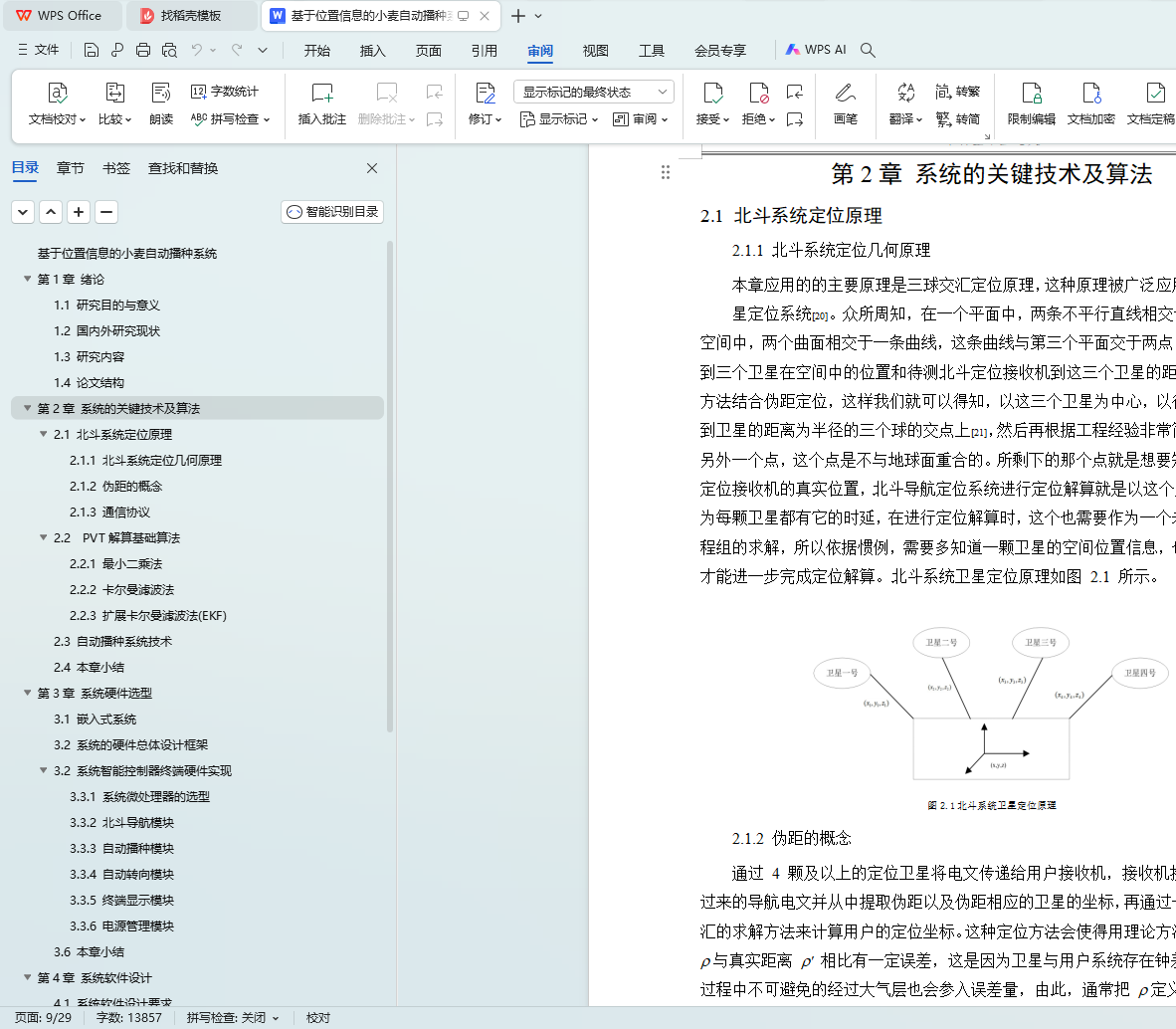
本设计是根据北斗导航卫星系统进行研究,结合了嵌入式软件及硬件开发、自动驾驶控制技术等智能化技术。主要设计包括以下几个部分。以树莓派为核心,利用北斗卫星导航对农机工作路线在地图上进行规划,和对农机进行位置信息接收。通过微型计算机控制农机的行进。利用光电传感器,监测播种装置。
关键词:北斗导航系统; 自动播种; 自动驾驶
Automatic wheat seeding system based on location information
Abstract:China's agriculture is changing to the direction of refinement, intelligence and intensification, and precision agriculture technology is introduced into agricultural practice, so as to promote the transformation of modern agricultural development mode and structural adjustment.Among them, "agricultural precision operation and informatization" as the key areas of agricultural modernization development, satellite navigation system and Gaofen satellite remote sensing system as spatial information infrastructure, is an important technical support for precision agriculture, and is the key technology for developing modern agriculture and realizing sustainable agricultural development.
This design is based on the research of Beidou navigation satellite system, combined with embedded software and hardware development, automatic driving control technology and other intelligent technologies.The main design includes the following parts.With Raspberry PI as the core, Beidou satellite navigation is used to plan the working route of agricultural machinery on the map and receive the position information of agricultural machinery.The movement of agricultural machinery is controlled by microcomputer.The seeding device is monitored by photoelectric sensor.
Key words: Beidou navigation System, Automatic seeding, Automatic driving
目录